Senderos de Mallorca
- English
- Castellano
- Català
- Deutsch
Camí des Correu

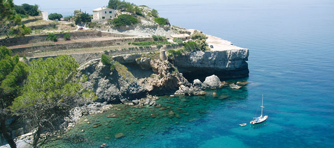
El Camí des Correu is an ancient route connecting the villages of Esporles and Banyalbufar. This old highway dating from 1401 runs among oak groves and fabulous views of the coast.
Route Details
Excursion type: Hiking
Location: Southwest of the Sierra de Tramuntana
Nearest town: Esporles
Degree of difficulty: Medium
Total distance: 8.230 km
Total length: 2 hours and 15 minutes
Access: By bus line L200. Palma-Esporles-Banyalbufar-Estellencs. By private car, take the Valldemossa highway from Palma (Ma-110) and then Ma-1120.
Starting point: Esporles Church
Circular path: No
Maximum altitude: 454 m
Minimum altitude: 117 m
Grade: 700 m
Accumulated uphill grade: 316 m
Accumulated downhill grade: 384 m
Recommended season: Year-round
Itinerary
-
Esporles Church
Distance 0.000 km - Time 0 hours - Altitude 180 m - N39 40'7.618" E2 34'38.819"
Take the church road up toward the coast of Sant Pere and after about 150 m, in a sharp curve, you will see the first sign for “Camí des Correu” indicated toward the left.
-
Esporles to Banyalbufar Highway (Ma-1100)
Distance 0.933 km - Time 15 minutes - Altitude 225 m - N39 40'7.918" E2 34'4.962"
Cross the highway and continue parallel to it for 10 min., then, when you cross it again, this time to the left, the irregularly paved stone path gently rises and crosses two portholes.
-
Coll des Pi
Distance 3.560 km - Time 1 hour and 15 minutes - Altitude 454 m - N39 40'38.459" E2 32'57.419"
The dense oak grove with numerous strawberry trees opens up toward the highest part of the route to afford you a glimpse of the north coast. A short time later the path begins to descend, narrows, crosses two dividing walls and reaches a cross-wise track.
-
S’Arbossar track crossroads
Distance 5.820 km - Time 1:45 - Altitude 360 m - N39 40'55.379" E2 31'46.981"
Cross it in a straight line (heading north) and take the paved track that goes downhill surrounded by stone terraces and with excellent panoramic views of the coast.
-
Banyalbufar
Distance 8.130 km - Time 2:15 - Altitude 110 m - N39 41'14.038" E2 30'49.499"
From the church, take the highway heading to Esporles for a few meters, and then turn onto the first perpendicular street to the left (Carrer Major). At the first junction, take the street to the left that passes by the Sa Coma hotel. Before you reach a large platform perched above the cliffs, turn right and go down the steps to the beach cove, passing by a waterwheel from the Arab period.
Other options
Tour of Banyalbufar: In this picturesque village, it is worth taking a stroll through the narrow streets towards the uphill district and, just before reaching it, turn left and take the walking path along the irrigation channel. You will enjoy the beautiful views of the village and the coast.
Remarks
Este itinerario esta incluido dentro del programa para la recuperación y difusión de los caminos de Esporles, "Camina per Esporles". Más información en la web del Ajuntament d'Esporles
Send a postcard
Send a postcard of Camí des Correu with a note for the recipient. Write the mailing details and press “send”.
© Mallorca Rural and the authors