Senderos de Mallorca
- English
- Castellano
- Català
- Deutsch
Excursions to discover Rural Majorca
De Sant Elm a La Trapa
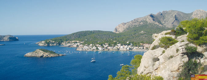
La Cala y la Torre d’en Basset
Excursión circular por una zona costera de gran belleza....- Excursion type: Hiking
- Location: Zona sur-oeste de Mallorca.
- Nearest town: Sant Elm (Andratx)
- Degree of difficulty: Medium
- Total time: 2 hours and 30 minutes
- Maximum altitude: 365 m
- Circular path: Yes
- Recommended season: Year-round
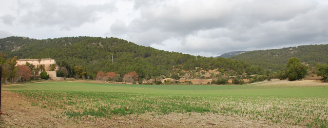
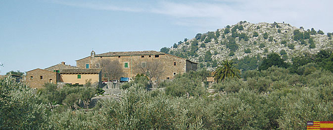
Ermita de Maristel·la y sa Fita del Ram

Se trata de una moderada subida a un excelente mirador sobre el pueblo de Esporles y desde donde podréis ver...
- Excursion type: Hiking
- Location: Sud-Oeste de la Sierra de Tramuntana
- Nearest town: Esporles
- Degree of difficulty: Family
- Distance: 3.050 Km
- Total time: 1 hour and 10 minutes
- Maximum altitude: 581 m
- Circular path: Yes
Camí de cas Ratat
Esglaieta - es Muntant - Esporles El camino que va desde la Esgleieta hacia Esporles...
- Excursion type: Hiking
- Location: Sud-Oeste de la Sierra de Tramuntana
- Nearest town: Esgleieta (Esporles)
- Degree of difficulty: Medium
- Distance: 11.880 Km
- Total time: 2 hours and 50 minutes
- Maximum altitude: 320 m
- Circular path: No
Camí des Correu
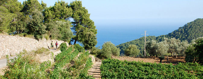
El Camí des Correu is an ancient route connecting the villages of Esporles and Banyalbufar. This old highway...
- Excursion type: Hiking
- Location: Southwest of the Sierra de Tramuntana
- Nearest town: Esporles
- Degree of difficulty: Medium
- Distance: 8.230 Km
- Total time: 2 hours and 15 minutes
- Maximum altitude: 454 m
- Circular path: No
- Recommended season: Year-round
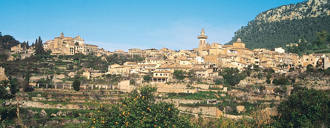
Ruta patrimonial urbana por Esporles
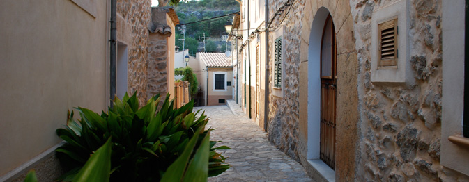
La ruta patrimonial urbana de Esporles recorre los rincones más emblemáticos y bellos de este pueblo de la...
- Excursion type: Hiking
- Location: Sud-Oeste de la Sierra de Tramuntana
- Nearest town: Esporles
- Degree of difficulty: Family
- Distance: 3.310 Km
- Total time: 1 hour and 1 minute
- Maximum altitude: 191 m
- Circular path: Yes
- Recommended season: Year-round
Sa Costera
Del mirador de ses Barques a Cala Tuent Itinerario costero de gran belleza, con dos partes...
- Excursion type: Hiking
- Location: Oeste de Mallorca
- Nearest town: Sóller
- Degree of difficulty: Medium
- Total time: 3 hours and 45 minutes
- Maximum altitude: 400 m
- Circular path: No
- Recommended season: Year-round
Puig des Teix
Loop route from Valldemossa
Despite the fact that it is not one of the highest peaks on...- Excursion type: Hiking
- Location: West Majorca
- Nearest town: Valldemossa
- Degree of difficulty: Medium
- Distance: 14.470 Km
- Total time: 4 hours and 30 minutes
- Maximum altitude: 1,064 m
- Circular path: Yes
- Recommended season: Year-round
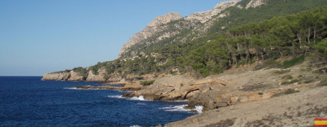
Puig des Galatzó
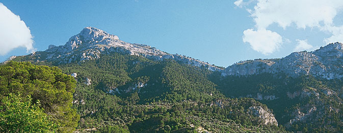
On the north side (Estellencs).
El Puig de Galatzó, with its pyramid shape, stands out...- Excursion type: Hiking
- Location: Southwest Majorca
- Nearest town: Estellencs
- Degree of difficulty: Medium
- Distance: 10.790 Km
- Total time: 4 hours and 15 minutes
- Maximum altitude: 1,027 m
- Circular path: Yes
- Recommended season: Spring,Autumn and Winter
Las aldeas entre Sóller y Fornalutx
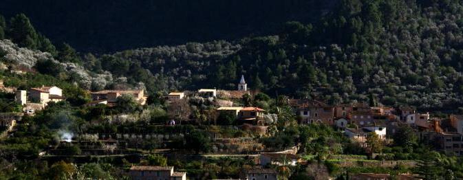
Itinerario que discurre entre el pueblo de Sóller y Fornalutx. Esta ruta atraviesa las...
- Excursion type: Hiking
- Location: West Majorca
- Nearest town: Sóller - Fornalutx (Sóller)
- Degree of difficulty: Low
- Distance: 7.810 Km
- Total time: 4 hours and 30 minutes
- Maximum altitude: 298 m
- Circular path: Yes
- Recommended season: Year-round
Can Picafort - Son Real
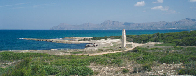
A coastal route along untouched shores with a view to a necropolis from the 7th Century BC. Later on, you...
- Excursion type: Hiking
- Location: North of Majorca – Alcúdia bay
- Nearest town: Can Picafort (Santa Margalida)
- Degree of difficulty: Family
- Distance: 8.560 Km
- Total time: 2 hours and 15 minutes
- Maximum altitude: 35 m
- Circular path: Yes
- Recommended season: Year-round
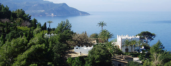
From Deià to Sóller
Passing by Cala Deià beach cove, Llucalcari and Camí de Castelló
A highly diverse...- Excursion type: Hiking
- Location: West Majorca
- Nearest town: Deià
- Degree of difficulty: Medium
- Total time: 4 hours and 30 minutes
- Maximum altitude: 300 m
- Circular path: No
- Recommended season: Year-round
El Cap des Pinar
Ascensión a la Penya des Migdia y a la Talaia d’Alcúdia Es el más atractivo de los tres...
- Excursion type: Hiking
- Location: al norte de Mallorca, en el Cap des Pinar.
- Nearest town: Alcúdia
- Degree of difficulty: Medium
- Total time: 5 hours and 0 minutes
- Maximum altitude: 444 m
- Circular path: Yes
- Recommended season: Year-round
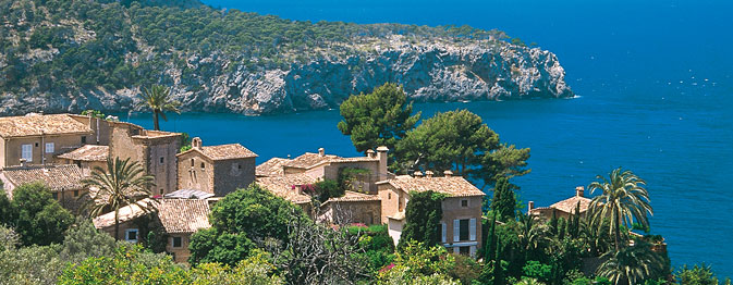
Miramar Monastery
A school was founded here in 1276 by King James II of Majorca, following a request by Ramon Llull, where...
- Excursion type: Hiking
- Location: West Majorca
- Nearest town: Valldemossa
- Degree of difficulty: Family
- Total time: 0 hours and 45 minutes
- Maximum altitude: 340 m
- Circular path: Yes
- Recommended season: Spring,Autumn and Winter
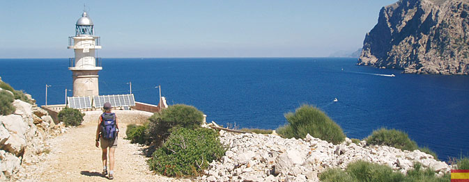
Coves and lookout platforms in Formentor
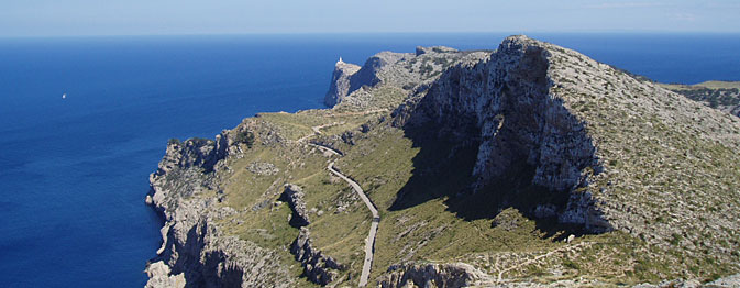
Ascent to El Fumat
Cap de Formentor is one of the most beautiful places on the island....- Excursion type: Hiking
- Location: North end of the Serra de Tramuntana
- Nearest town: Formentor (Pollença)
- Degree of difficulty: Medium
- Total time: 2 hours and 15 minutes
- Maximum altitude: 334 m
- Circular path: Yes
- Recommended season: Year-round
Parque Natural de la isla de Sa Dragonera
Ascensión al faro de Na Pòpia
La isla de Sa Dragonera, situada a unos centenares de...- Excursion type: Hiking
- Location: frente al cabo suroeste de Mallorca.
- Nearest town: Sant Elm (Andratx)
- Degree of difficulty: Family
- Total time: 2 hours and 45 minutes
- Maximum altitude: 353 m
- Circular path: Yes
- Recommended season: Year-round